Ombrulla Logo

Autonomous Drone & Rover Inspection for Hard-to-Reach, Hazardous Assets

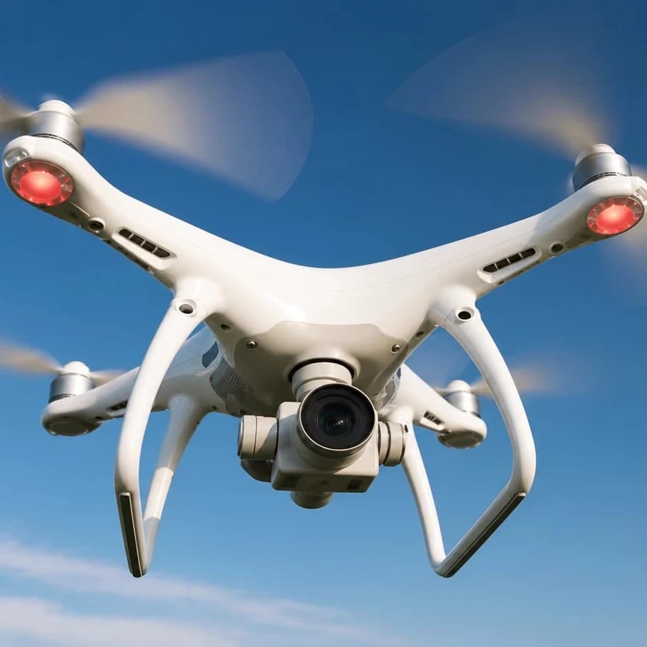
Ombrulla sends drones and ground rovers to the pipelines, tanks, towers, flare stacks, and confined spaces your people shouldn't have to climb, enter, or stand next to — capturing AI-ready visual and sensor data with no one at the asset. Not a handheld app for a person walking the site. Not a fixed camera on a production line. If the problem is physical access or hazard exposure to a fixed asset, this is the tool.
65%

Lower Inspection Cost

Replace scaffolding, rope access, and confined-space shutdowns with a drone or rover flight plan.

70%

Less Personnel Exposure

Cut time people spend in elevated, confined, or hazardous zones by sending the robot in first.

60–90%

Earlier Defect Detection

Catch corrosion, cracks, and leaks between scheduled turnarounds, not just during them.

30–50%

Reactive to Predictive

Shift maintenance planning from surprise failures to scheduled fixes.

Why AI Infrastructure Inspection Matters

  • AI-powered drones and robotic rovers inspect hazardous, inaccessible, and widespread industrial assets without exposing personnel to unnecessary risk.
  • -Inaccessible assets: Inspect flare stacks, pipelines, vessels, and offshore structures remotely.
  • -Large-scale infrastructure: Cover pipelines, tank farms, and utility corridors faster.
  • -Safer operations: Reduce confined-space entry, work at height, scaffolding, and standby crews.
  • -Less disruption: Perform inspections between shutdowns and detect deterioration earlier.
  • -Unified asset intelligence: Connect drone, rover, and IoT sensor data to one asset record.
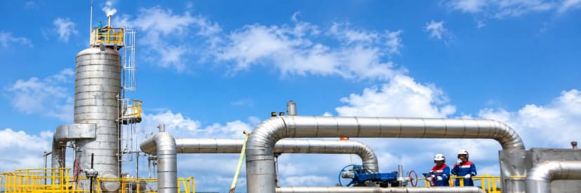
Engineer inspecting a rusty pipe in an industrial setting, demonstrating real-world infrastructure inspection use case.

AI Visual Inspection

Has a fixed camera mounted on a production line or conveyor, running continuously with no person in the loop

What AI Infrastructure Inspection Does - Fixed, Hard-to-Reach, Hazardous Assets

  • AI infrastructure inspection detects corrosion, cracks, leaks, coating failure, structural deformation, and thermal anomalies across fixed industrial assets. Using drones, ground rovers, advanced cameras, and thermal sensors, it enables safer inspection of elevated, confined, extensive, remote, or hazardous infrastructure without requiring personnel to enter high-risk areas.
AI inspection of pipelines and elevated pipe racks detecting corrosion, leaks, cracks, and coating damage.

Pipeline Inspection

Detects corrosion, leaks, cracks, coating damage, and insulation failure across pipelines and elevated pipe racks.
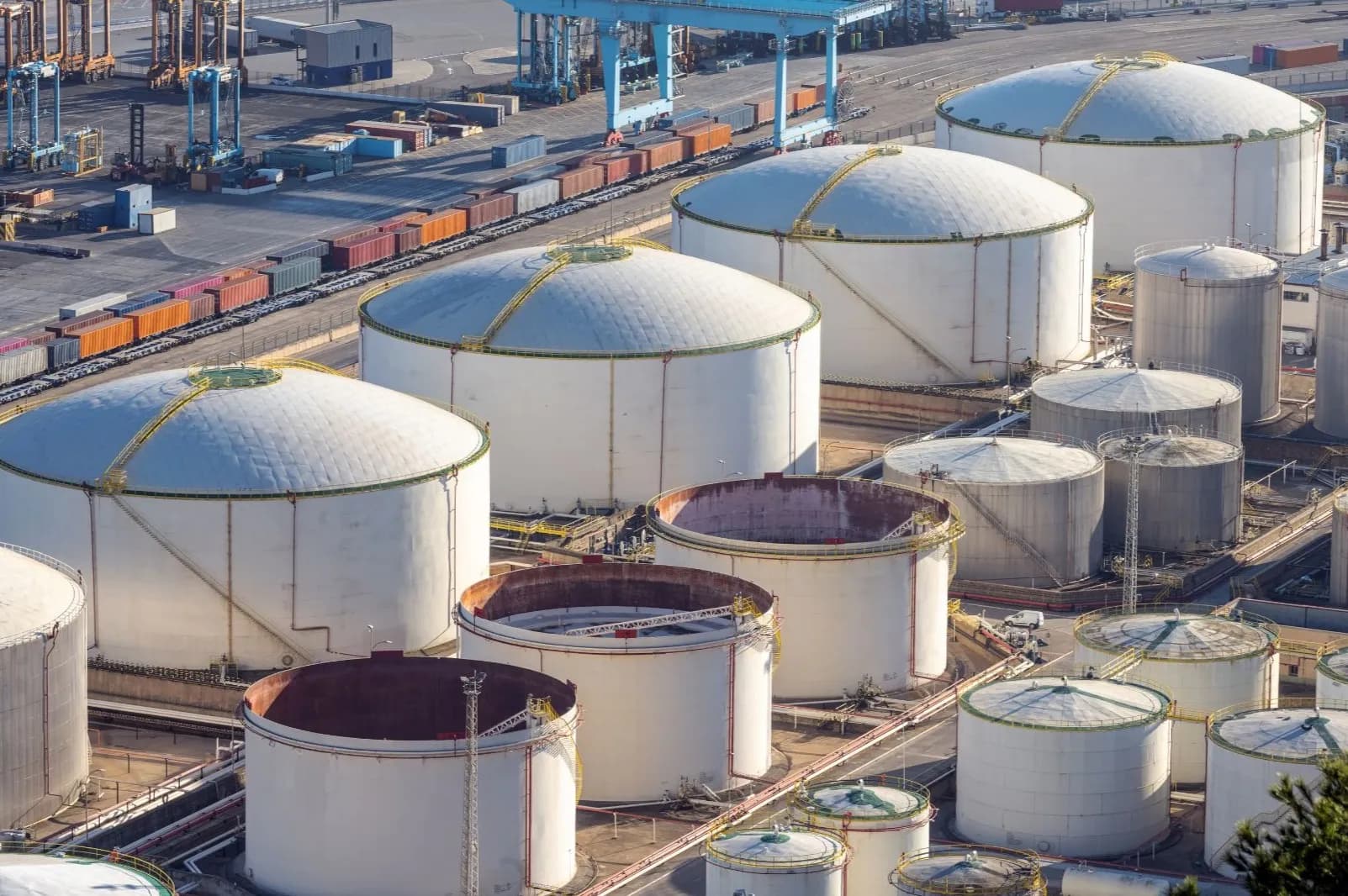
AI inspection of tanks identifying shell corrosion, roof damage, weld defects, and deformation without scaffolding.

Tank Inspection

Identifies shell corrosion, roof damage, weld defects, and deformation without scaffolding or confined-space entry.
AI drone inspection of flare stacks, towers, and high structures for corrosion and structural wear.

Elevated Structures

Inspects flare stacks, towers, and high structures for corrosion, loose components, and structural wear.
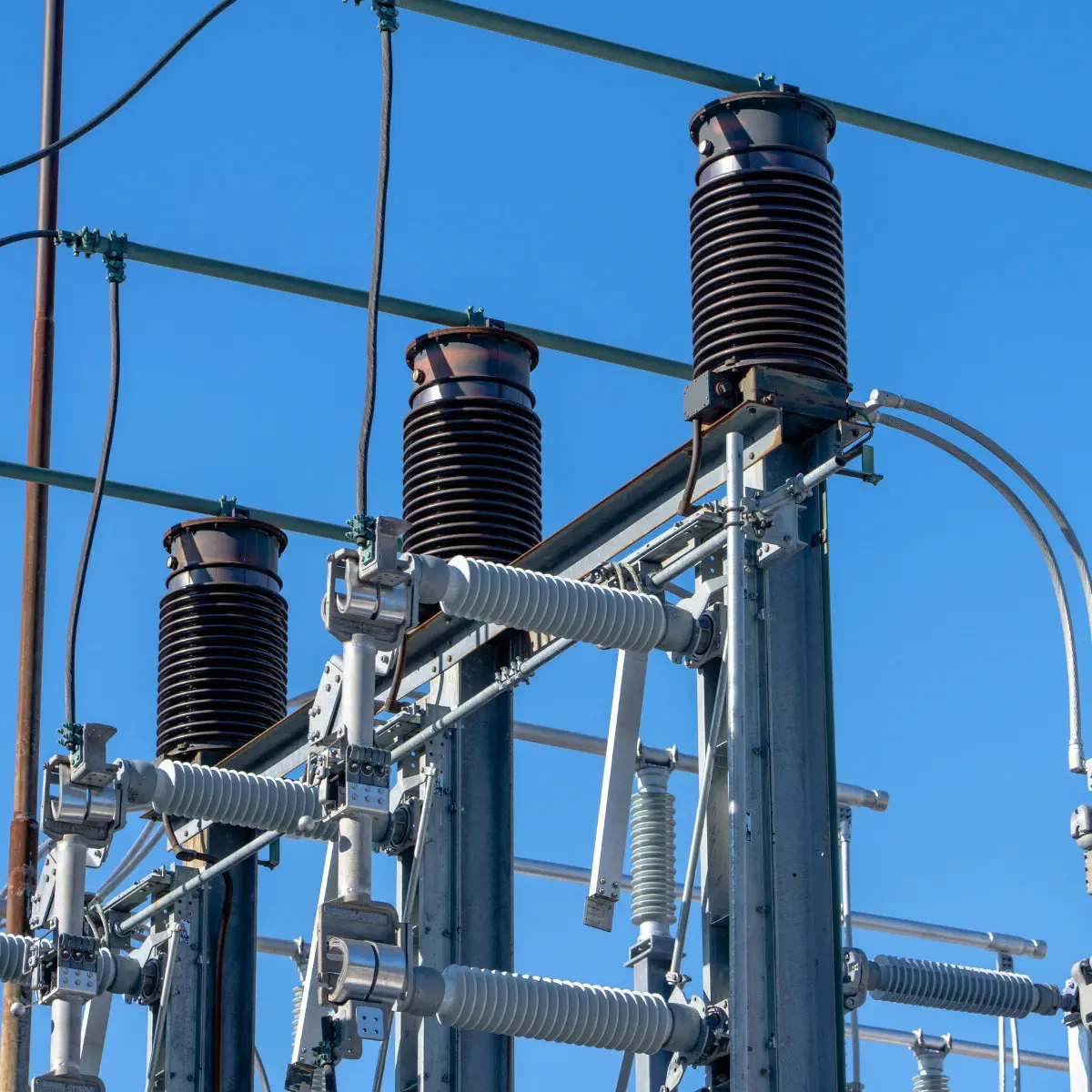
AI inspection of power lines and transmission infrastructure detecting insulator defects and overheating.

Power Infrastructure

Detects damaged insulators, loose hardware, corrosion, and overheating across power lines and transmission assets.
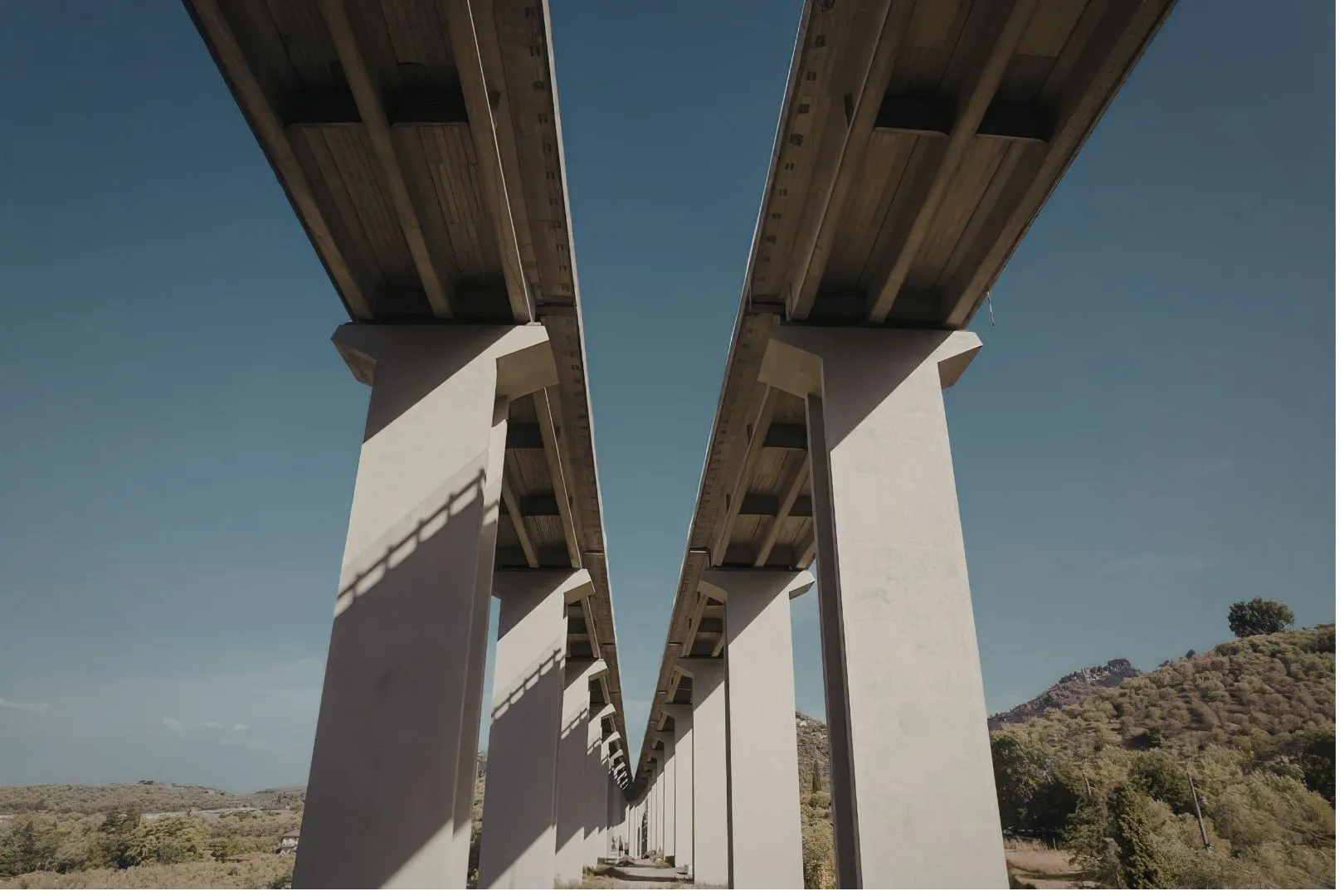
AI monitoring of bridges and civil infrastructure identifying cracks, concrete deterioration, and structural movement.

Civil Structures

Identifies cracks, concrete deterioration, structural movement on bridges and other critical infrastructure.
Ground rovers inspecting tanks, tunnels, and vessel interiors without hazardous personnel entry.

Confined Spaces

Ground rovers inspect tanks, tunnels, and vessel interiors without exposing personnel to hazardous entry.
AI inspection of offshore platforms and marine infrastructure detecting corrosion and coating failure.

Marine Assets

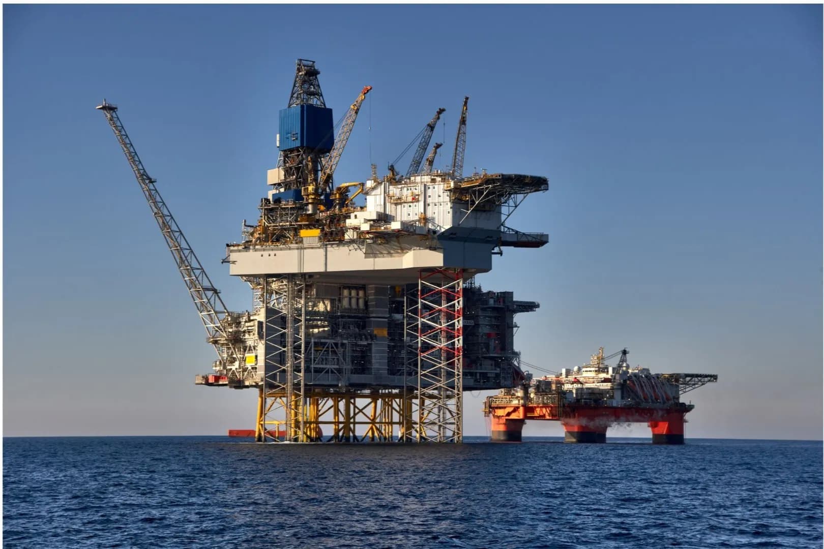
Detects corrosion, coating failure, and structural damage across offshore platforms and marine infrastructure.
1/0

How AI Infrastructure Inspection Works

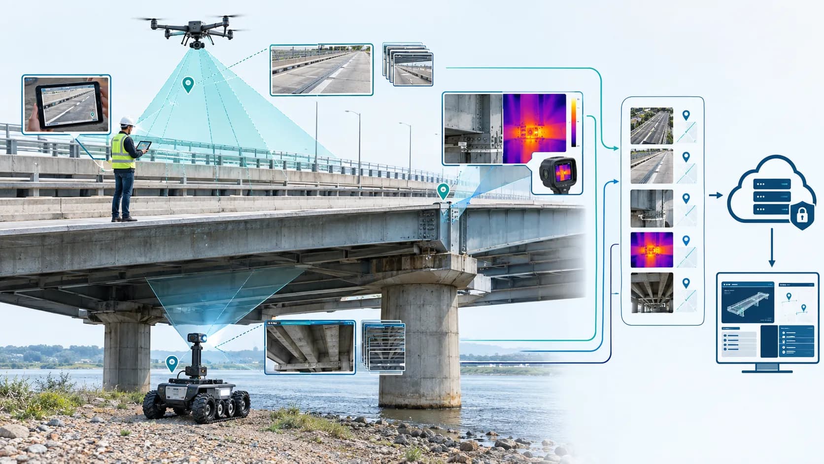
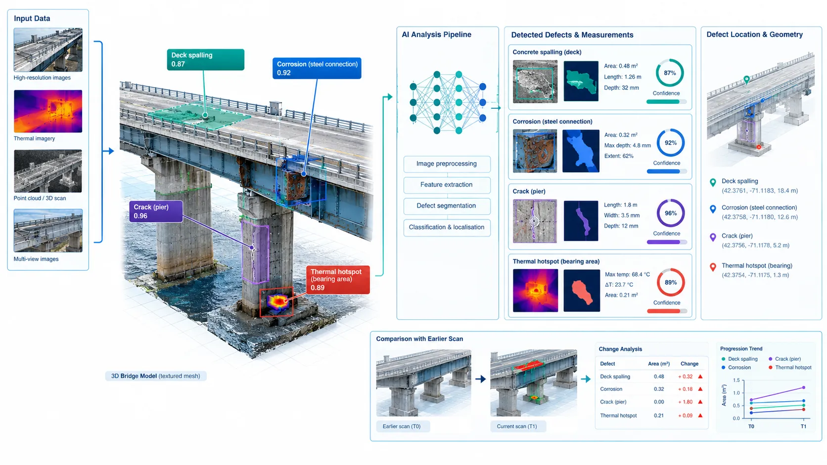
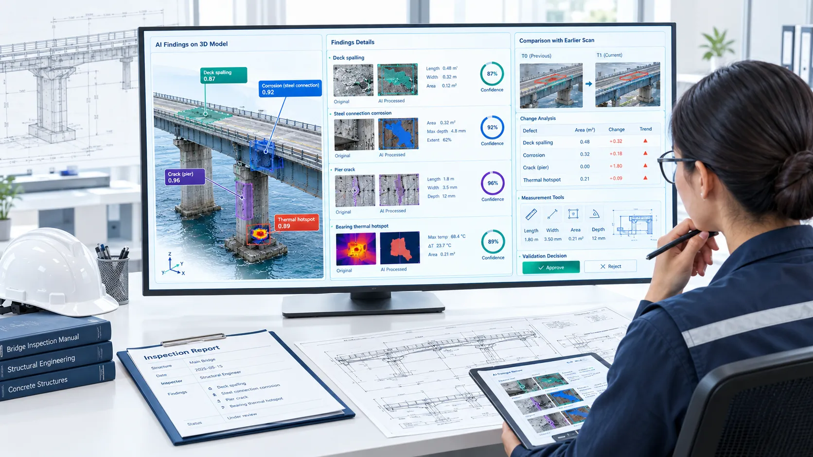
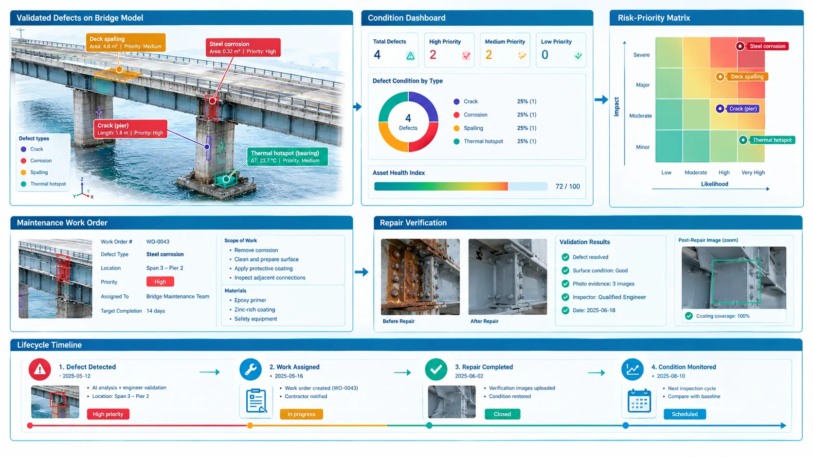
  • AI infrastructure inspection combines structured asset data, repeatable field capture and computer vision to identify defects across bridges, buildings, roads, railways, towers, pipelines and utility assets. Images, videos, thermal data, LiDAR and 360° imagery are linked to their exact asset locations and analysed by AI. Qualified inspectors then validate the findings before corrective actions are prioritised, assigned and tracked—creating a complete condition history throughout the asset lifecycle.

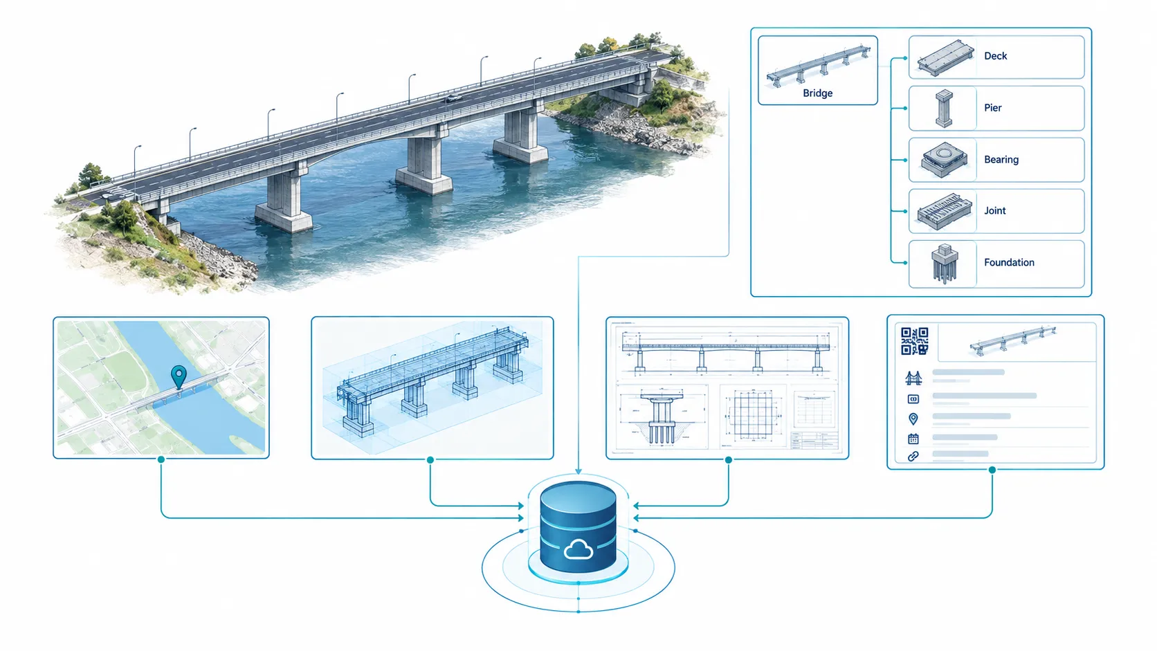
Step 1: Asset Onboarding

Create a structured digital record of every infrastructure asset, its components, location and inspection requirements.

Deliverables:

  • -Georeferenced asset register with site, asset, component and inspection-zone hierarchy.
  • -Linked GIS maps, BIM models, drawings, previous reports and reference images.
  • -Defined defect categories, condition grades, severity rules and inspection standards.
Scientific engineering illustration showing digital onboarding of infrastructure assets into a structured component hierarchy with GIS maps and BIM models.

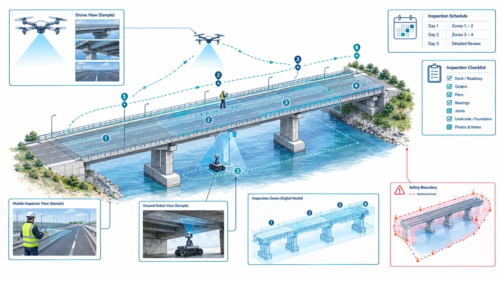
Two Capture Modes

Some of Our Customers

LEONI
ENI
Green Palm Marine
Howard Kane
Engineer inspecting a rusty pipe in an industrial setting, demonstrating real-world infrastructure inspection use case.

Need a person to walk the asset instead?

Mobile AI Inspection is built for inspectors who can safely reach the asset on foot with a phone or tablet.

Why Organizations Choose Ombrulla

  • Unlike conventional inspection software that focuses only on image analysis, Ombrulla delivers an end-to-end enterprise inspection ecosystem-combining AI, computer vision, IoT, asset management, workflow automation, and enterprise integrations into a single platform. This enables organizations to standardize inspections, improve safety, reduce maintenance costs, and maximize asset reliability across their entire infrastructure portfolio.
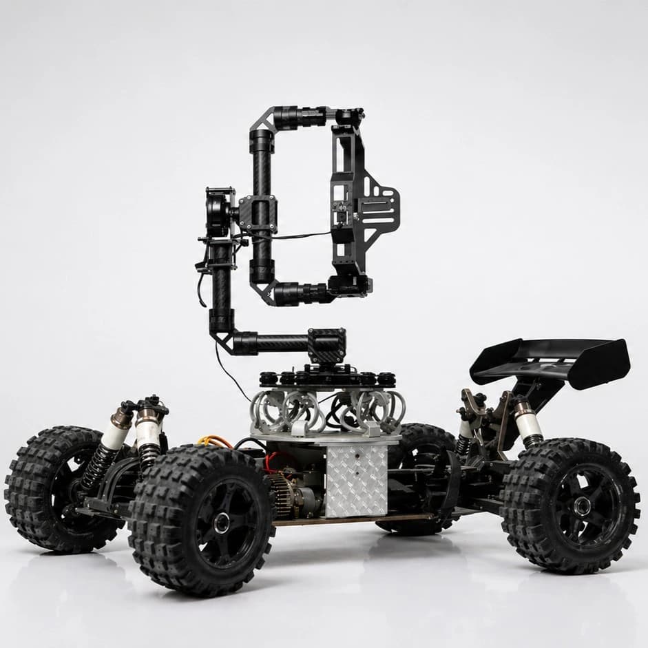
Hardware-Agnostic Data Capture

Hardware-Agnostic Data Capture

Bring your own drones, rovers, or cameras; the platform works with what you already own instead of forcing a single vendor's ecosystem.

Multi-Modal AI Detection

Multi-Modal AI Detection

Visual, thermal, and sensor data come together into one signal instead of three separate readings to piece together yourself.

Continuously Learning Models

Continuously Learning Models

The AI gets sharper the more it inspects your specific assets, rather than staying fixed at ship-day accuracy.

Unified System of Record

Unified System of Record

PETRAN and TRITVA run as one platform, so asset data and AI insights live in the same place instead of six different tools.

Real-Time Edge-to-Cloud Processing

Real-Time Edge-to-Cloud Processing

Defects get flagged the moment they're spotted, not after a batch upload finishes processing hours later.

Enterprise-Grade Security by Design

Enterprise-Grade Security by Design

Access controls, encryption, and audit trails are part of the foundation.

Native Enterprise Integration

Native Enterprise Integration

Plugs into the ERP, CMMS, and GIS systems you're already running.

Frequently Asked Questions

What counts as ‘autonomous’ drone and rover inspection?

Capture happens without a person present at the asset. A drone flies a planned or beyond-visual-line-of-sight route, or a rover navigates a programmed path through a confined or hazardous zone. A remote pilot or operator may control or supervise the flight or drive, but no one stands at the pipe, tank, or structure itself the way a handheld inspection requires.

Does this replace Mobile AI Inspection?

No. Mobile AI Inspection is built for an inspector who can physically and safely walk up to an asset with a phone or tablet. This page covers the opposite case — assets that require aerial or ground-robotic access because a person can't reach them safely or practically. Both run on the same PETRAN/TRITVA platform.

Does this cover factory-line quality control?

No. AI Visual Inspection (Tritva) runs a fixed camera on a production line for continuous, line-speed inspection of moving product with no person in the loop. This page covers fixed, stationary infrastructure assets — pipelines, tanks, towers, bridges — not products moving down a line.

Can drones fly beyond visual line of sight (BVLOS) for pipeline or power line routes?

Yes, subject to your local aviation authority's approval — an FAA Part 107 BVLOS waiver, EASA authorization, or the applicable regional equivalent. Ombrulla's platform supports route planning and data ingestion for BVLOS operations wherever the operator holds the required authorization.

Can a rover inspect the inside of a storage tank or confined vessel without a person entering?

Yes. Ground rovers are built to navigate confined and enclosed spaces — tank interiors, tunnels, vaults — on a programmed path, capturing visual and sensor data without triggering a confined-space entry permit for a human inspector.

What if the site has no reliable connectivity?

The platform supports edge computing, so drones, rovers, or edge gateways can capture and analyze data locally in remote or offline environments. Once connectivity is restored, inspection data syncs to the cloud for centralized reporting and analytics.

Who operates the drone or rover — Ombrulla or our team?

The platform is hardware-agnostic and operator-agnostic. It works with drones and rovers you already run, flown or driven by your own certified pilots and operators, or coordinated through certified partners — whichever fits your existing safety and aviation program.

What defects can this detect?

Corrosion, cracks, coating failure, leaks, thermal hotspots, structural deformation, missing or loose components, weld defects, and water ingress, depending on the sensors and AI models deployed for the asset type.

Which industries use autonomous drone and rover inspection?

Oil & gas, energy and utilities, civil infrastructure, transportation, construction, renewable energy, water utilities, and mining — anywhere fixed assets are elevated, confined, extensive, or hazardous enough that routine human access carries real cost or risk.

Does it integrate with our existing CMMS, EAM, or GIS systems?

Yes. The platform integrates with systems such as SAP, IBM Maximo, and other CMMS/EAM/GIS platforms, so confirmed findings can automatically generate work orders and maintenance records instead of requiring manual re-entry.

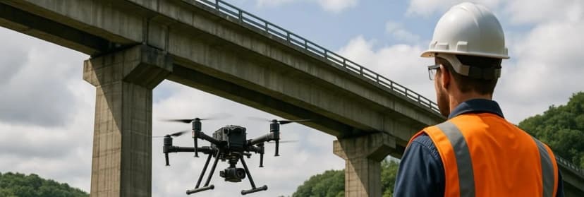
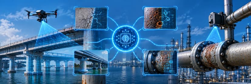
AI-powered drone inspection detecting cracks and corrosion across industrial pipelines and bridge infrastructure.

See How AI Vision Detects Micro-Cracks and Corrosion on Your Hardest-to-Reach Assets.

Share your asset specs with our team for a personalized platform walkthrough and data compatibility review.