AI Infrastructure Inspection
Leverage AI-driven drones, rovers, and IoT-powered insights to ensure safer, faster, and cost-efficient inspections across industries
Save 40–65% on inspections while cutting high-risk site time by 50–70% with AI-guided drones and mobile checks.
Shrink unplanned outages by 25–40% and speed inspection cycles by 70–85% to keep operations moving.
Increase assets inspected per week by 60–90%, no extra headcount thanks to automated defect detection.
Shift 30–50% of work from reactive to predictive and cut emergency call-outs by 20–35% with AI-prioritized actions.
One AI platform for inspections across air, ground, and handheld—standardizing how work gets done, accelerating decisions, reducing risk, and protecting uptime and cost at enterprise scale.

Bring drone, rover, and mobile inspections into a single, seamless workflow. From triage to work orders to reporting, everything runs through one trusted data fabric.
→
Equip field teams with AI-enabled smartphone apps and predefined checklists to capture the right evidence every time, drive uniform compliance, and turn routine rounds into actionable, audit-ready data.
→
Autonomous drone missions deliver high-resolution imagery and video of pipelines, rigs, wind turbines, and bridges, expanding coverage, reducing exposure hours, and minimizing shutdowns while surfacing issues earlier.

Rugged ground rovers navigate complex terrains and confined spaces, collecting both visual and sensor data in areas too dangerous or inaccessible for people.
Our AI-powered inspection system turns IoT sensor data and field insights into real-time decisions, helping businesses detect risks earlier and act faster.

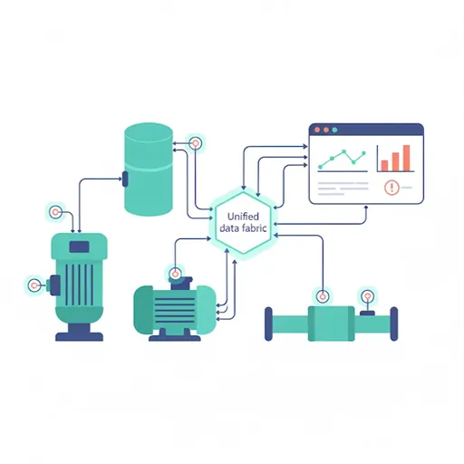
Seamlessly connect to a wide range of IoT-enabled devices and sensors—capturing high-frequency signals like vibration, temperature, corrosion, pressure, and more—in real time, unifying them into a single, reliable data fabric that powers continuous monitoring and deeper operational insight.

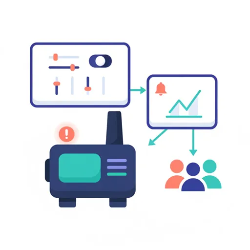
Configure automated, policy-driven triggers that instantly notify the right teams the moment thresholds are breached or abnormal patterns emerge, enabling rapid response that minimizes downtime, mitigates risk, and prevents costly incidents before they escalate.

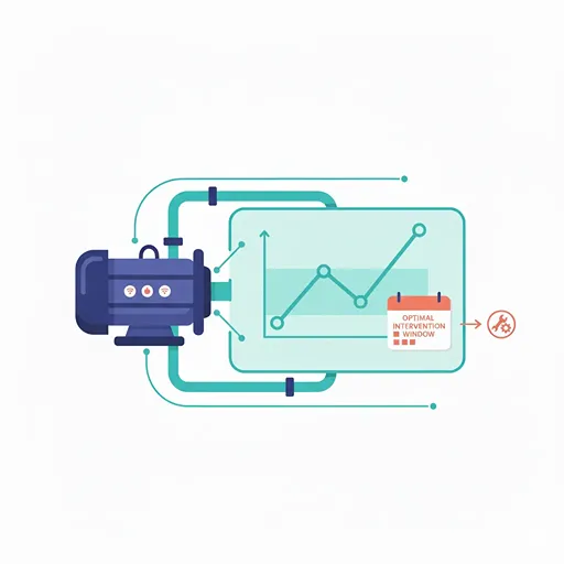
Leverage advanced AI that fuses live telemetry with historical performance trends and contextual metadata to forecast potential failures with precision, recommend optimal intervention windows, and systematically optimize maintenance schedules to extend asset life and reduce total cost of ownership.
Our AI-powered infrastructure inspection platform, combining AI Drone Inspection and Mobile AI Inspection, delivers measurable value across finance, operations, and technology.

Proactively predict and prevent equipment failures before they occur, enabling smoother, interruption-free operations, higher production throughput, and more reliable service levels across every shift.

Minimize human exposure to hazardous or hard-to-reach environments by leveraging drones, rovers, and AI-guided mobile inspections that capture high-quality data remotely while enforcing safer, standardized procedures.

Reduce inspection and maintenance spending by automating routine checks, using predictive analytics to target only the work that matters, and aligning parts, labor, and downtime windows with data-driven precision.

Roll out consistent inspection workflows across sites and asset classes using cloud-based, enterprise-ready technology that centralizes data, simplifies governance, and grows seamlessly as your footprint expands.
Experience the future of infrastructure inspection in action through results-driven case studies spanning across industries, showing how AI Drone Inspection and Mobile AI Inspection slash costs, speed decisions, and elevate safety from the field to the boardroom.


A ready-to-deploy, enterprise-grade platform combining AI Drone Inspection and Mobile AI Inspection delivers autonomous data capture, on-device/edge defect detection, secure workflows, and seamless integrations, keeping your infrastructure safer, smarter, and future-ready.

Detect anomalies and defects the moment they emerge by applying advanced machine learning models that continuously analyze high-frequency signals, images, and contextual metadata to surface actionable insights with speed and precision.

Continuously stream asset health data in real time from sensors monitoring vibration, corrosion, temperature, pressure, and other critical parameters, consolidating heterogeneous inputs into a single, trustworthy source of truth for operations and reliability teams.

Unify drone, rover, and mobile inspection workflows in one integrated platform that standardizes data capture, automates analysis, and streamlines handoffs from field collection to engineering review and remediation.

Forecast failures before they occur by combining live telemetry with historical performance trends and environmental context, enabling targeted interventions that reduce unplanned downtime and extend equipment life.

Standardize inspections with predefined, auditable workflows that are easy to tailor by asset type or site, ensuring consistent procedures, complete traceability, and faster onboarding for new teams.

Centralize insights in enterprise-grade dashboards that deliver secure, role-based access to KPIs, trends, and investigation drill-downs, making it simple to share findings and drive accountability across the organization.

Protect sensitive inspection and operational data with end-to-end encryption, fine-grained access controls, and compliance-ready safeguards that align with corporate policies and industry regulations.

Improve results over time as models learn from newly captured data, operator feedback, and evolving operating conditions, steadily increasing accuracy while reducing false positives and manual review effort.
AI infrastructure inspection uses computer vision and machine learning to analyze imagery (often from drone inspection or fixed cameras) and automatically detect defects on assets like bridges, roads, rail, pipelines, power lines, and wind turbines.
Systems ingest photos, videos, or LiDAR, then run models to identify cracks, corrosion, spalling, vegetation encroachment, loose fasteners, and other anomalies, producing reports with severity, location, and recommended actions.
Drone inspection reduces downtime and risk, reaches hard-to-access areas, and captures high-resolution data faster; AI then accelerates review and improves defect consistency.
Bridges, highways, tunnels, dams, railways, transmission towers, substations, pipelines, storage tanks, solar farms, wind turbines, telecom towers, and industrial roofs.
Well-trained models typically surpass manual visual-only detection for repeatable issues; accuracy depends on image quality, training data, and asset type. Many teams see double-digit gains in detection recall with fewer false negatives.
Savings come from fewer site visits, faster reporting, reduced outages, and earlier fixes. Typical returns show up as 30–70% time savings on analysis and fewer emergency repairs over time.
Minutes to hours for standard missions, depending on media volume, connectivity, and whether human QA is added.
You cut rope work, scaffolding, lane closures, and repeat trips. Costs shift toward drone missions and software, but total project cost usually drops—especially on recurring inspections.
Use drones with stabilized gimbals and high-res RGB; thermal or LiDAR helps for certain assets. Many platforms and cameras are supported if imagery meets resolution/overlap guidelines.
Yes—AI can process both, though frame extraction from video may be used to maintain image sharpness for detections.
Absolutely. Ground cameras, pole cams, crawlers, and static CCTV streams can feed the same AI pipeline.
Cracks (longitudinal, transverse), spalling, delamination cues, rust staining, efflorescence, joint damage, potholes, rutting, and guardrail issues.
Yes—AI flags rust, coating breakdown, pitting patterns, and blistering, often with pixel-level segmentation to quantify affected area.
Detects broken insulators, missing cotter keys, loose dampers, vegetation encroachment, and hotspot anomalies when thermal data is available.
For wind, AI spots blade cracks, leading-edge erosion, lightning strikes. For solar, it detects soiling, hotspots, PID, and module damage.
Plan the mission, capture imagery (e.g., drone inspection flight), upload to the platform, let AI analyze, then review, QA, and export work orders to your CMMS/GIS.
Yes—look for APIs and native connectors for Esri, Autodesk, SAP, Maximo, Infor, or similar systems to sync locations and maintenance tasks.
No—capture offline and upload later. Some platforms also offer edge processing for remote environments.
Many tools score severity and risk, then auto-rank findings to create a prioritized maintenance list.
Usually yes when flown under the relevant civil aviation authority rules (VLOS/BVLOS, night ops, waivers). Always verify local regulations and pilot certification.
Choose platforms with encryption in transit/at rest, role-based access, regional data residency options, and audit logging.
No—AI augments inspectors by pre-screening data and standardizing defect recognition; humans validate and make final judgments.
Poor lighting, motion blur, extreme angles, occlusions, and novel defect types not seen in training data. Good capture protocols and model updates mitigate this.
Yes—custom model training/fine-tuning with your labeled imagery improves performance over time.
As a rule of thumb, ensure the smallest defect of interest spans 6–10+ pixels across its narrow dimension; higher GSD improves detection confidence.
Use human-in-the-loop QA, confidence thresholds, and feedback loops to retrain and reduce noise.
High model performance, explainable results, strong QA tools, open integrations, secure cloud/on-prem options, versioned datasets, and clear licensing.
Many vendors support on-prem, private cloud, or hybrid for regulated environments.
Common models: per project, per asset, per flight hour, per image/GB, or tiered subscriptions with usage add-ons.
Yes—most teams start with a scoped pilot on a small set of assets to validate accuracy, workflow fit, and ROI.
Basic flight planning (if using drones), image quality standards, and platform onboarding. Most field teams ramp in days, not months.
Evaluate flight safety record, sensor options, data handoff, AI accuracy metrics, turnaround time, and integrations with your maintenance stack.
Depends on asset criticality and regulation: some assets need quarterly or after extreme weather; others annually. AI helps optimize intervals based on condition trends.
Identify your challenge, and we're here to help